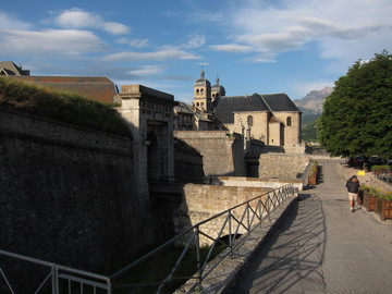
Walls around Briançon Old Town
4 July 2011
People were cleaning up from the medieval faire when we left in the morning.
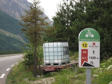
We headed up towards Col du Lautaret under overcast skies. The road was a shallow climb over a moderate-sized highway. Here and elsewhere in the Alps near major passes there is signage that shows the current altitude and the grade for the next kilometer.
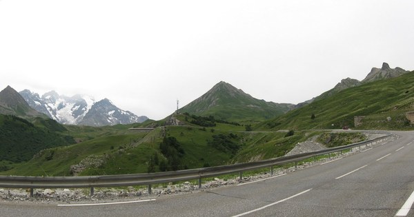
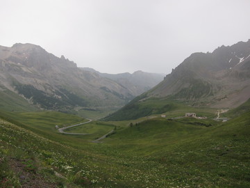
At the pass, we took a road that just keeps going up to an even higher pass, Col du Galibier. Here it started to rain. The climb was beautiful and gave good views of the valley we had just come up (as good as could be expected considering the rain, anyway).
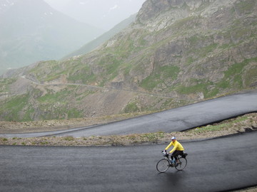
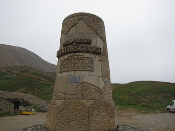
Galibier is one of the highest passes that the Tour de France regularly routes across. On the way up there is a monument to Henri Desgrange, creator of the Tour.
At the summit we decided we had had enough rain, and the descent looked no better, so we packed our bikes up. We drove down, had a multi-course lunch at a hotel, then drove past Col du Télégraphe, which we probably would have crossed that day if we had had good weather.
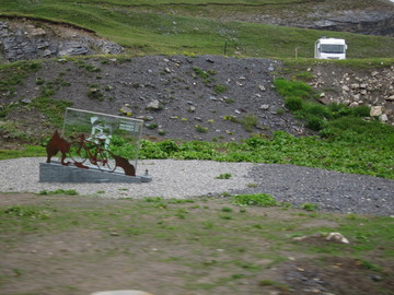
The Tour de France is a really big deal for the towns on and near the route, and we saw that nearly all of them had been gearing up for the Tour; many had installed little monuments to welcome the cyclists and the tourists.
We continued driving and ended up stopping in St-Michel-de-Maurienne. Our hotel felt like a dorm: very spartan, but clean and modern. (Weirdly, the reception was on the 4th and top floor of the building.) We had dinner at an Italian restaurant, where I learned that kir is delicious. Oh, kir, where have you been all my life?